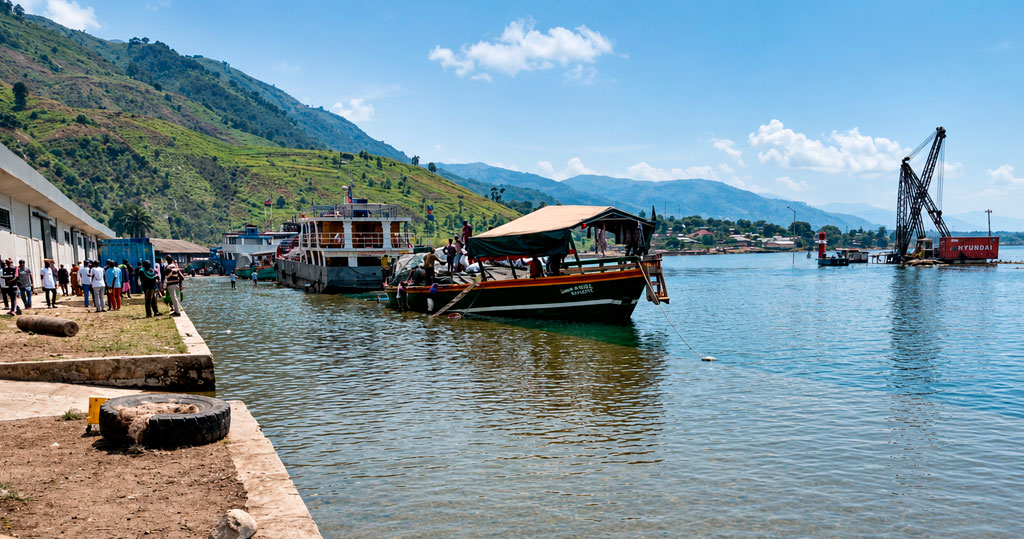
TYPSA has prepared the design for the refurbishment and expansion of the International Port of Kalundu (Uvira, South Kivu, Democratic Republic of the Congo), a key logistics hub on the Central African corridor. This project, funded by the World Bank as part of the Great Lakes Region Trade Facilitation and Integration Project (PFCIGL), incorporates, for the first time, a rigorous analysis of rising Lake Tanganyika water levels under various climate change scenarios, resulting in a resilient design that anticipates operating conditions for the coming decades.
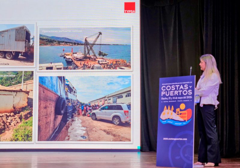
A strategic port in precarious conditions
The Port of Kalundu is the second most important port in the Democratic Republic of the Congo and the main hub on the central transport corridor, linking the Great Lakes region with the seaport of Dar es Salaam in Tanzania. Its location at the northern end of Lake Tanganyika makes it an essential link for communities and economies in an area lacking access to an efficient road network.
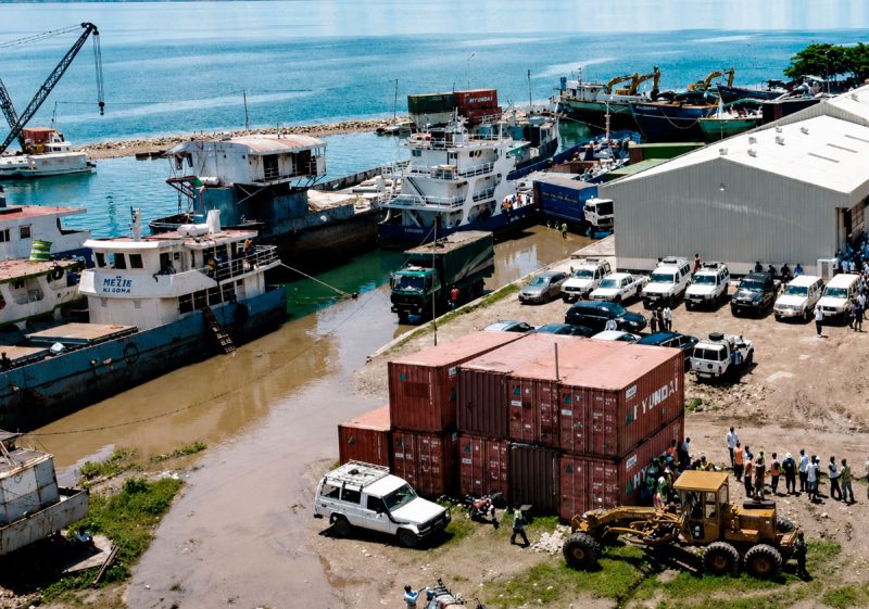
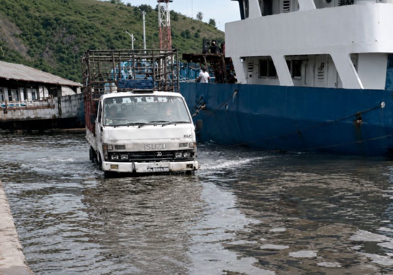
When TYPSA took on the project, the port was in an advanced state of disrepair: ageing infrastructure, insufficient operational space (26,440 m² of area and 355 metres of quay length), chronic sedimentation problems caused by torrential runoff from nearby slopes, and in particular a quay crest elevation (+767 metres) that had already proved to be insufficient. In April 2024, flooding of up to one metre in height on the quays brought operations to a standstill for several weeks.
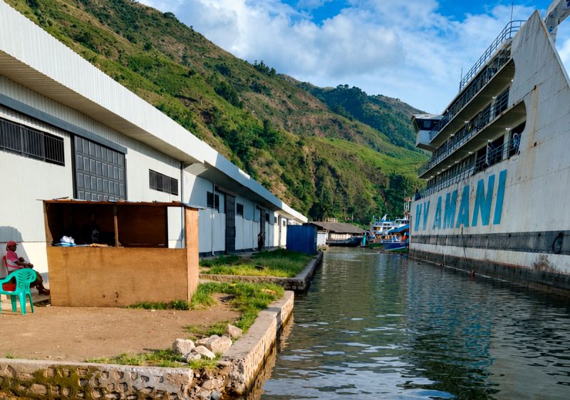
The geopolitical context of South Kivu added a further complication: the fieldwork had to be planned and carried out under stringent security conditions, which gave the project a unique character.
Methodology: scarce data, innovative solutions
One of the greatest challenges was the scarcity of reliable historical data. The solution was a methodological approach that combined intensive fieldwork with the extensive use of remote sensing and advanced numerical models developed by IHCantabria.
Firstly, a field survey was carried out, comprising topography, bathymetry, and geotechnical and geophysical investigations (5 boreholes, 6 exploratory wells, and terrestrial and marine seismic profiles). The results revealed the presence of an underwater canyon up to 50 metres deep alongside the breakwater, a decisive factor in the design of the extension, which had to run parallel to the coast to avoid areas of great depth.
To characterise the lake’s historical behaviour, IHCantabria processed more than 1,200 satellite images (LANDSAT and Sentinel-2, from 1986 to 2024) and radar altimetry data from multiple space missions. This morphodynamic study confirmed an upward trend in the lake’s water level, with high seasonal variability and recent episodes exceeding historical records. The main innovation lay in the projection of water levels under climate change, based on statistical downscaling techniques using artificial intelligence, a method that enables the derivation of meteorological and climatic information with high spatial resolution at a local scale from low-resolution global models. Using historical hydrological and meteorological data, along with global climate projections (SSP2-4.5 and SSP5-8.5 scenarios), an increase of 47 centimetres in the average lake level was estimated for the period 2041–2060, with a more pronounced rise in the high-emissions scenario. This approach, compared with traditional dynamic downscaling, drastically reduced the costs and time required for the analysis without compromising technical rigour.
The analysis was complemented by a study of climate and internal wave agitation (using the Simulating Waves Nearshore (SWAN) and Mild Scope Equations (MSP) models) and a calculation of operational viability in accordance with ROM 3.1-99 criteria, which verified that the various proposed port configurations met the operational shutdown thresholds for the anticipated vessel types.
The design: resilience, capacity and scalability
The studies carried out enabled the design crest level to be set at +769.00 metres, resulting from the sum of the extreme lake level for a 237-year return period (+768.51 metres), the increase due to climate change over a 25-year horizon (+0.47 metres) and the semi-amplitude of the design wave (+0.10 metres). This means raising the quays by 2 metres compared with the current situation.
The proposed expansion includes the construction of a new 196-metre-long container quay, designed to accommodate vessels up to 81 metres in length and with a draught of 5 metres, on a pile foundation that ensures the transfer of loads to the load-bearing strata at a depth of 10 metres or more. The total operational area will increase from 26,440 m² to 43,440 m², and the total length of the quays from 355 to 530 metres.
The design also includes the refurbishment and raising of the existing quays, selective dredging at the berthing area, the renewal of service networks, improvements to access routes and the demolition of obsolete facilities. The configuration adopted is scalable; the design allows for future extensions to the port should traffic demand require it.
Scientific dissemination and international recognition
The results have gained recognition both within the professional sector and in the international scientific community. In August 2025, a delegation from TYPSA presented the work at the Australasian Coasts & Ports 2025 conference, held in Adelaide (Australia), where the presentation was particularly well received for its focus on adapting port infrastructure to climate change in contexts where data is scarce. Similarly, in May 2026, Virginia Martín, from the Ports and Coasts division, presented a technical paper at the 18th Spanish Conference on Coastal and Port Engineering (Huelva).
The project is currently in the tendering phase for the construction works, having successfully completed the institutional validation phase in the Democratic Republic of the Congo.